


River Affric to Alltbeithe
- Download larger map & elevation chart in pdf format click here!
- STAGE 3 ROUTE DATA
- Start: River Affric (57.264982, -4.984857)
- Finish: Alltbeithe (57.232014, -5.183494)
- OS Landranger Map: 25 (Glen Carron & Glen Affric)
- Total Distance: 8.4miles/13.5km
- Max Altitiude: 1024ft/312m
- Min Altitude: 768ft/234m
- % of Ascent: 43%
- Total Ascent: 715ft/218m
- Total Ascent Distance: 3.6miles/5.8km
- % of Descent: 34%
- Total Descent Distance: 2miles/3.2km
- Total Descent: -623ft/-192m
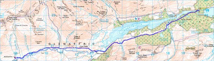
 Stage 3 of the Affric Kintail Way extends from the River Affric car park to the SYHA Glen Affric Hostel at Alltbeithe. The car park is an ideal location for those who have made a pickup/drop off arrangement with accommodation providers. There is also a local taxi service Foten Taxis. From the car park return to the forestry road on the south side of the River Affric where Section 2 of the route finished and continue on to the west.
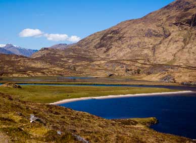
After about a mile you will catch a glimpse of Affric Lodge at the narrow part of the watercourse while starting to take in the views of majestic mountain scenery. Sgurr na Lapaich and An Tudair partially screen the main ridge with the twin peaks of Carn Eige and Mam Sodhail - the highest mountains north of the Great Glen. The footpath to Cougie heads south from the forest road just before crossing the Allt Garbh. Shortly afterwards the road passes close to Loch Salach Ghuibhais and like Coire Loch a haven for dragonflies.
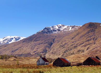
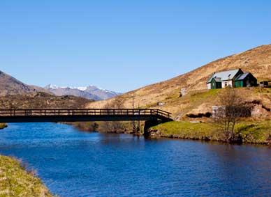
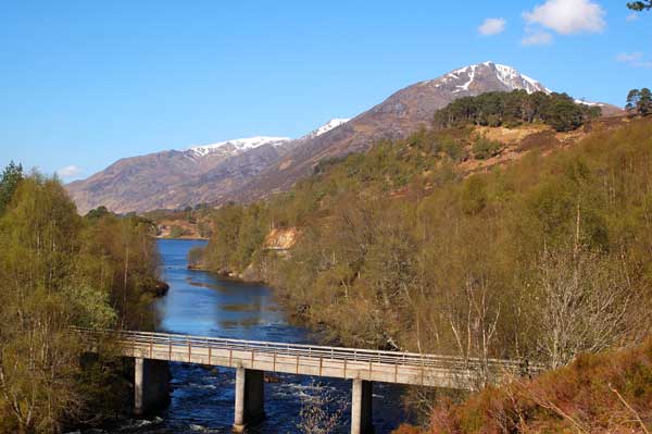
Soon the mountains of Kintail come into view and as also the old settlement at Athnamulloch, the old house and outbuildings now owned by FCS. The last family to live here left in the 1950s though cattle was still brought to graze here from Strathglass for another two decades. Here the route crosses the River Affric by the bridge at Strawberry Cottage. This building is owned by the An Teallach Mountaineering Club and is available for hire throughout the year.
About 0.5k beyond Strawberry Cottage a track on the right is the return leg of the poular circuit of Loch Affric. This could of course be used as an alternative route from the River Affric car park although it is a lot rougher underfoot and there are several burns to cross, one in particular akward to cross in wet weather.
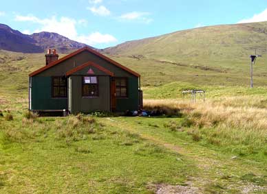
Continuing west by the River Affric for about 6km you arrive at the Glen Affric Youth Hostel an ideal base for perhaps tackling the neighbouring Munros of An Socach, Sgurr nan Ceathreamhnan and the outlying Mullach na Dheiragain.
On this section of the AKW especially when the bracken is low you can see evidence of how Glen Affric, like many Highland glens, was quite densely populated in earlier centuries. There are a number of ruins of old settlements virtually all the way along Loch Affric to Altbeithe. Check with the Scottish Youth Hostel Association for opening times and booking conditions. Campers for a small fee can use the hostel facilities if camping nearby.


